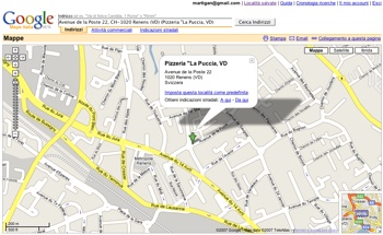
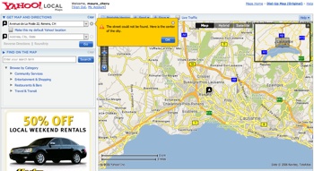
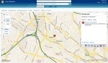
Yesterday I was looking for a Pizzeria nearby. As I remembered the address I just wanted to see the map to orientate myself to reach it. As I had a couple of spare minutes I tried to look it up on three different map services to compare the different features offered. I chose Google Maps, Microsoft Live Local, and Yahoo Maps. The three services have comparable features … on the surface. Below the surface their philosophy is completely different.
Google Maps is an extreme open Geographical Information System. Their gazetteer is really good in parsing the query string and looking up the right place. However the site poorly support Annotations: it is possible to save the location but is not possible to define groups of annotations or to share them. The web site clearly says: please mash me up with something else!
Yahoo Maps is USA-centered. It could not find the address I was looking for in Switzerland. Their interface is ADS oriented but the support to save different location is right visible from the home page. I am not sure that is possible to create groups of annotations.
The most comprehensive and user-oriented service is Microsoft Local Search. The interface offer really interesting features like integration of 2D and 3D browsing of the maps (while Google has two separate platform for that), annotations and collections. A collection is a group of pushpin that can be shared or tagged for different purposes. Their web interface allows also to create polygons areas on the map, draw lines, etc.
In sum the winner, IMHO, is Microsoft Live Local, which offer the most comprehensive set of features. The interaction is certainly more rich and offer customization and sharing possibilities that the other services does not offer. One of the missing features though is a strong connection with portable devices. It would be great if I could somehow bring these annotations with me, ready to be used while on the road. Also, the social networking side is clearly underdeveloped. We are seeing just the beginning of annotation sharing.
![]() Tags: geographical serach, geography, interaction design, Location Based Services, map algorithms, maps
Tags: geographical serach, geography, interaction design, Location Based Services, map algorithms, maps


